Everest Base Camp via Gokyo Lakes (Part 3 of 7)
Did anyone say Everest views?
Trekking Day 8: Acclimatization day at Namche
The windows in the room were thick with condensation, but N. told me to wipe the water away and look outside. It was a marvel to see one snow-covered peak after another after another just sitting there outside the windows.
But all was not majestic inside.
I couldn’t fall asleep until 2 am and woke up at 6 am, but not too much worse for wear.
For N. it was a miserable night: he had an upset stomach, a headache, his throat was rough, and he felt as if he couldn’t breathe — it got so bad that he said he almost had a panic attack. He didn’t sleep a wink. He now viscerally understood just how much human beings need air to live! Downer thoughts lingered at night: why in heavens name did I choose to do this? He was feeling bad enough that he didn’t fight too much the idea of going later to the mountaineering clinic in town.
On today’s itinerary was an acclimatization hike to the Everest Viewpoint. We walked out of our teahouse with ATG, but after just one block N. made noises about feeling nauseous, so we stopped by the clinic. It wouldn’t open until 9 am, so we agreed that ATG would stay with him and I would go to the viewpoint hike with Gyunju.
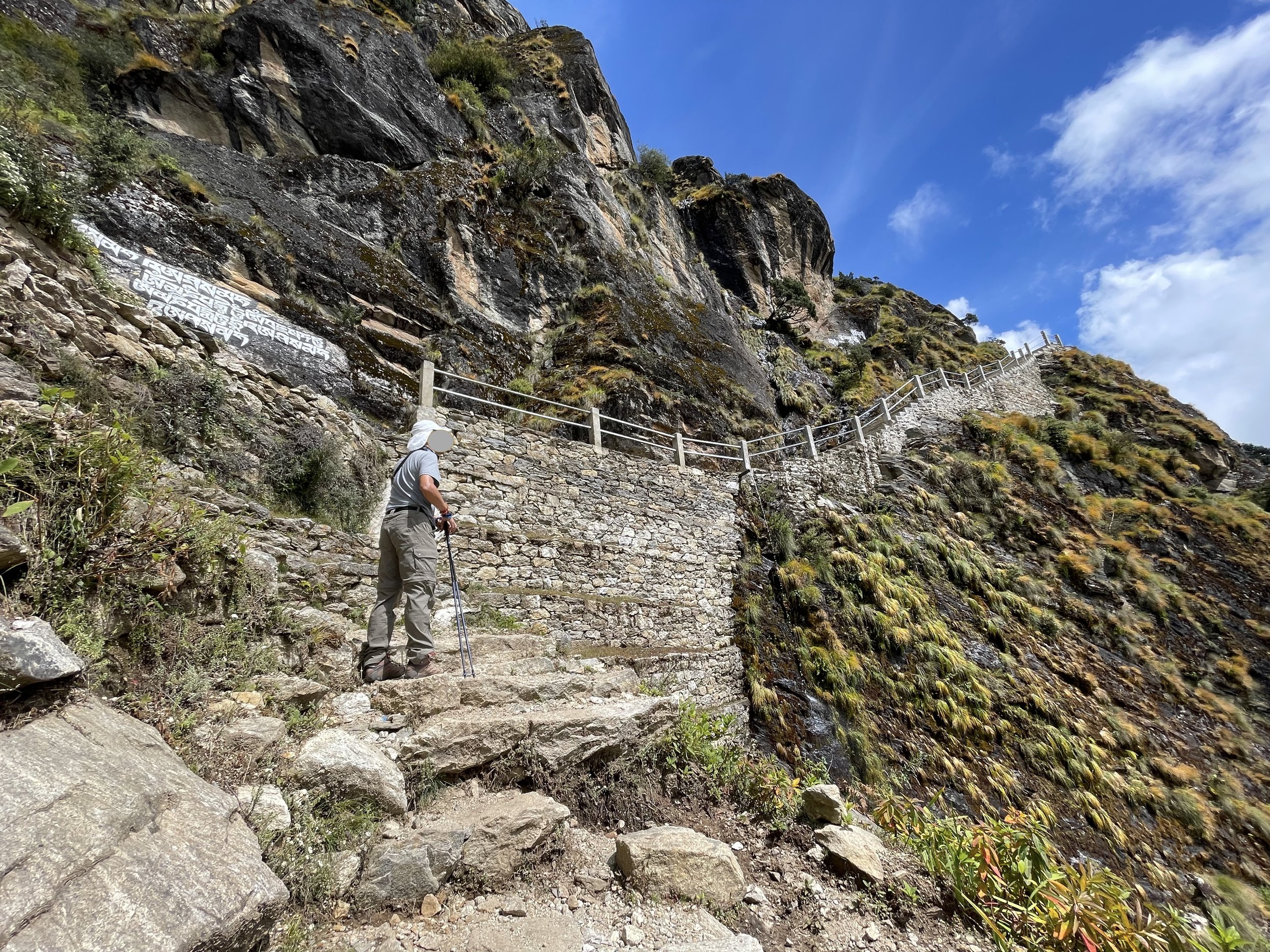
Once I got going, it was clear to me that it was a good thing that N. didn’t come: the trail was rocky, one switchback after another, going “up up up”, in Balaram’s words. The viewpoint was at 3,880 meters.
High altitude + sunny day + upward climb = slow and steady.
From what I could gather from Gyunju, the main peaks visible from the early part of the trail were Kongde and Thamserku, which is considered a holy mountain and, hence, unclimbable.
As I climbed higher and higher, more and more peaks revealed themselves until I reached the viewpoint and, on this clear day with brilliant blue skies, there they were: Everest, Lhotse, Ama Dablam, among others.
I had read somewhere that the recommended time on the viewpoint for acclimatization purposes was about 20 to 30 minutes. I think I pushed that to double the time — just to be safe — probably to Gyunju’s irritation. I ended up striking a conversation with a couple of guys from Israel, who told me their harrowing tale about driving a jeep from Manathi to Lukla, through roads that had become rivers during the latest rainstorm.
Since I could not communicate with Gyunju, I tried to ask other guides whether the next complex I could see just beyond the next hill was the Sherpa museum ATG had mentioned. Reaching it took about 30 minutes, but a museum it was not: it was the Hotel Everest View, which had pretty much the same view as the viewpoint I had just left. The one difference was that the hotel served very expensive coffee, which I shared with Gyunju since it was getting close to lunch time.
There was nothing to do but turn back. By the time I reached the viewpoint on my way back, the clouds had rolled in and it was almost as if the mountains were not there.
I was just really sorry that N. didn’t get a chance to see the snow-capped mountains that he loves so much and I think my enjoyment was a bit muted because he wasn’t there. He went to the mountain clinic, spoke with an English-speaking doctor, and listed his symptoms and got a fistful of medication: vitamin C and a cough suppressant; Diamox for altitude sickness (even though we brought these); and a course of antibiotics. He already seemed to be feeling better.
***
After I came back from the trek, N. and I had lunch and went to run a few errands around town. We exchanged some more cash (who knows how much battery pack charging will cost at higher altitudes), and also bought a little green collapsible cup and a few prayer flags.
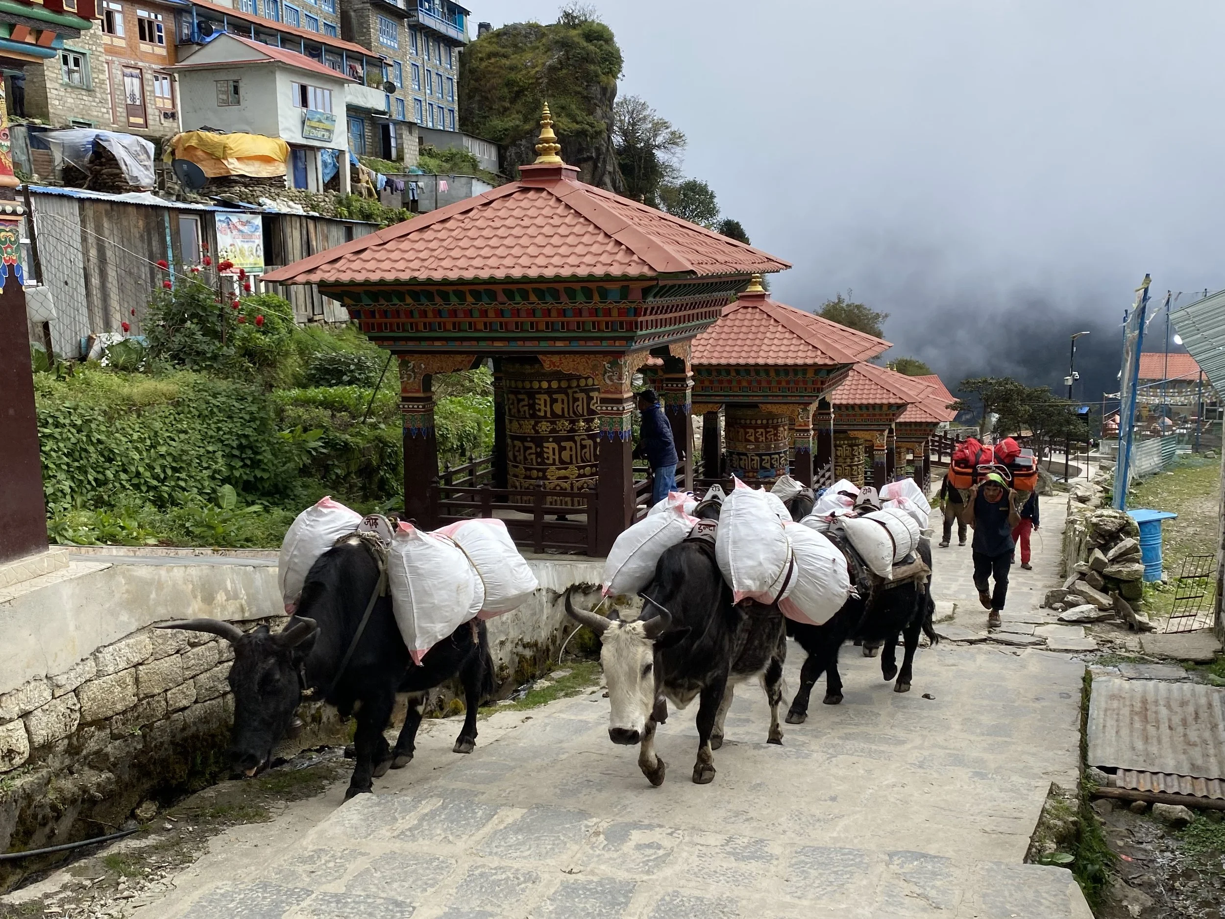
Walking down the main drag of town, we saw the prayer wheels again, along with the jopke bringing heavens-knows-what into town. The coolest was seeing a group of young dudes — I’m guessing they’re guides and porters — playing a very good game of volleyball.
Back at the teahouse, I took a warm shower — NPR 500. This will be my last one until the end of the trek. The trekking company prohibits showers above 4,000 meters to prevent trekkers from getting a cold or worse. Because he’s sick, N. was told not to take one today. From now on, baby wipes only, baby.
After dinner, we had updates from ATG. Currently the EBC was closed due to a landslide; the trail was gone. The Nepalese government sent about 35 soldiers to work to rebuild and reopen the road — the local tourism industry depended on it. Kala Pathar was accessible. It seems Cho La Pass, which was snowed out, was also being plowed by locals and was currently accessible too. Snow over the Gokyo Lakes were covering their deep sapphire color; the only thing to do was hope that the snow would melt before we got there.
Onwards and upwards — literally and figuratively.
***
Trekking Day 9: Namche to Phorse Thanga (3,680m/12,073ft)
With the required morning routine of packing our sleeping bags into their compression bags, one can see the differences in our personalities: I fold and roll mine methodically while N. haphazardly pushes and shoves his into the sack.
Thank heavens he feels better! (True, he’s pretty drugged up…)
Before leaving we squeezed in one more shopping expedition around the corner because the owner of the teahouse let me know that they had the traditional wool aprons I’d been looking for in Thamel. I was happy to get some as gifts — instead of the nylon ones they sell in the capital.
Our first stop was the Tenzing Norgay museum, which wisely had been built with a picture perfect framing of the mountains: Everest, Nupse, Lhotse and Ama Dablam. More than the mountains themselves (which I had seen yesterday from a higher vantage point), it was great to see N. see them for the first time. He went mad with the views and could only do what he did best — take photos.
The day was clear and sky, blue. Our trek today took us to a wide softly undulating uphill about 400 meters below the Everest Viewpoint I had climbed to yesterday. The trail was wide and easy, but best of all, every time we turned a corner, that mountain view was framed anew. No matter how many times it made an appearance, it was impossible not to admire.
Just before our teahouse break, our guide arranged for him to carry our water and sent both porters ahead to where we would stop for lunch. As soon as they left, we realized our mistake: now we had no snacks for our tea; no toilet paper, no place to store the large camera lens.
Lunch was dal bhat at a teahouse in which a larger group had been finishing lunch. By the looks of things — an oxygen canister was being packed into a bag — someone in the group was not able to continue on the trek. Gulp.
From trail gossip, it seems that our three miserable rainy days stuck in Manthali were actually a blessing in disguise. I remember hearing from the trekking office that a group of twelve from his company had been in Namche while we were waiting for the rain to stop in Manthali, and I remember being jealous about that. However, it seems that all that rain was actually snow in the mountains, so any group that had started before the deluge of September 24 ended up hiking in rain in the lower trails — with clouds and without views.
Those in higher elevations ended up having to turn around because the snow had come so hard that trails had closed altogether. In the teahouses we overheard several groups, small and large, who were coming down the mountains because of a miserable combination of bad weather and bad trails and plane tickets that could not be changed. (In Namche, we spoke with the father of a family of three from Australia who got turned around because Gorekshep was closed completely; he was philosophical about the whole thing, “Hey, when the mountain decides you won’t climb, it’s better to turn around…”).
All of which was mind-boggling to me, because so far we’ve had perfect weather.
At one point when we were coming downhill on rocky wet trail and I was losing my balance, I think I felt our guide tap me — gently but tap me nonetheless — on the side of my arm. The image that came to my mind were those young men leading the yaks or donkeys, tapping the animals to get them going. It didn’t feel good.
The village of Phorse Thanga had just 3 buildings, so we didn’t have much choice in accommodations. A small building had the common living-dining room and the rooms were upstairs, on a slanted set of steps. Most challenging was the bathroom at the end of the hall: just a toilet and large buckets of water. We were not in Namche anymore: there was definitely no carrot cake. From now on, all villages ran on solar power alone.
During dinner we met a Czech trio who were planning to do the same trek as we, but they were the crazy species who drove to Manthali and then hiked from there to Lukla. They planned to stop before Machchermo tomorrow because they were intentionally trekking without altitude meds. We traded trail gossip and bid them good night.
At the end of day meeting today, ATG again asked that we leave our door unlocked, as we did yesterday. But yesterday he had said something about letting more air into the room, in this altitude. Fine. Today he mentioned that he would come to check on us in the middle of the night. I thought that was strange and locked the door. And double checked it.
***


